Hughes Estate 3D model
Item
Title
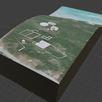
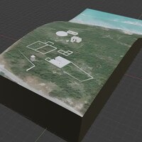
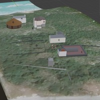
Hughes Estate 3D model
Description
3D map of site historic structures over topographic data built in Blender with GIS plugin.
Creator
Elysia Petras
Date
18-20th century occupation
Spatial Coverage
Anguilla, B.W.I
Temporal Coverage
Plantation era buildings mapped on google earth data, created in 2021.