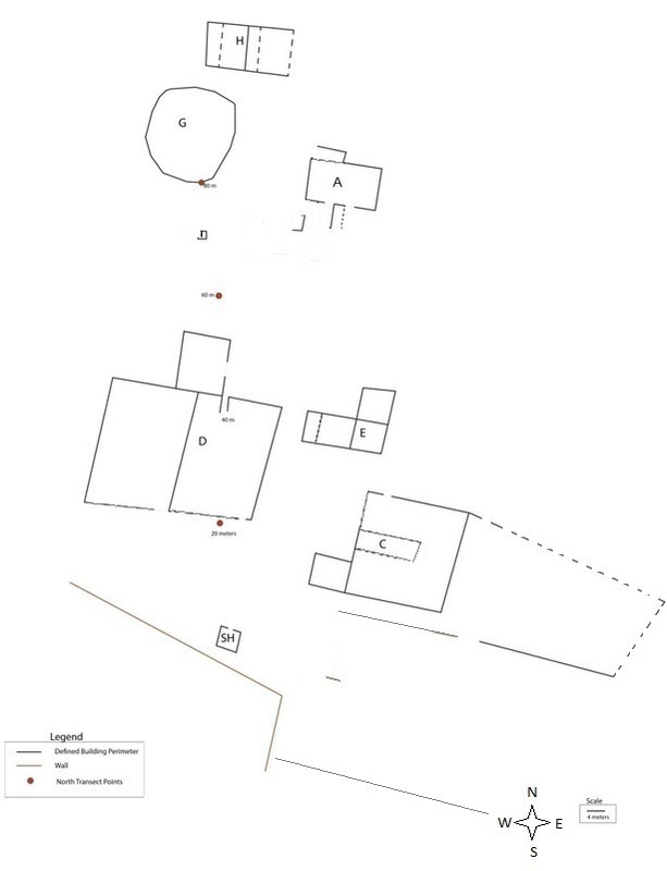
Hughes Estate Map
The First Research Season: Mapping
The first season of the Hughes Estate Archaeological Project was spent locating historic structures and creating a map of the site.
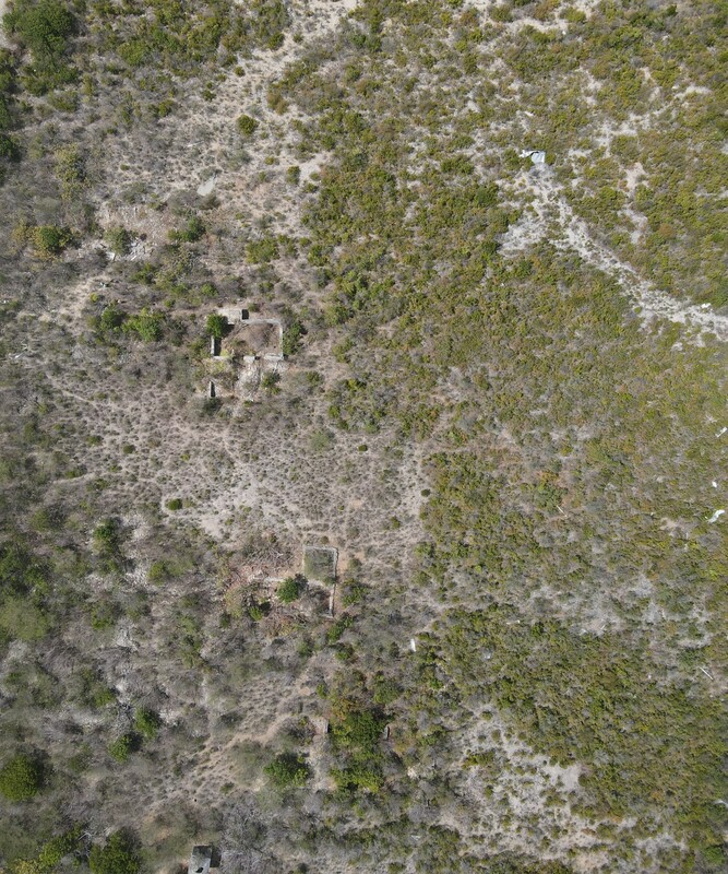
The historic structures, the majority of which are reduced to foundations, were not visible from existing aerial satellite imagery due to dense vegetation. Additionally, there are no known inventories or historic maps of Hughes Estate in existence.
Findings from 2019: The mapping team made their way through the thick overgrowth to find and plot historic structures. We located and mapped nine structures and two field walls, establishing Hughes as the most extensive historic plantation site remaining on Anguilla today. Two of the plantation structures appear to be associated with sugar processing (G and H), two with crop and animal husbandry (D, F), one with plantation foodways (SH), one with waterways (C), and three specifically with administration or the household (A, E, I). Identifications are based on diagnostic architecture, analysis of artifacts, archival inferences and comparative research. However, many of the identifications remain tentative as no maps of the plantation nor detailed description of buildings exist in historical records related to Hughes. Click on links (A-I, and SH) in the text or subnavigation pane the top of the page to learn more about each location.
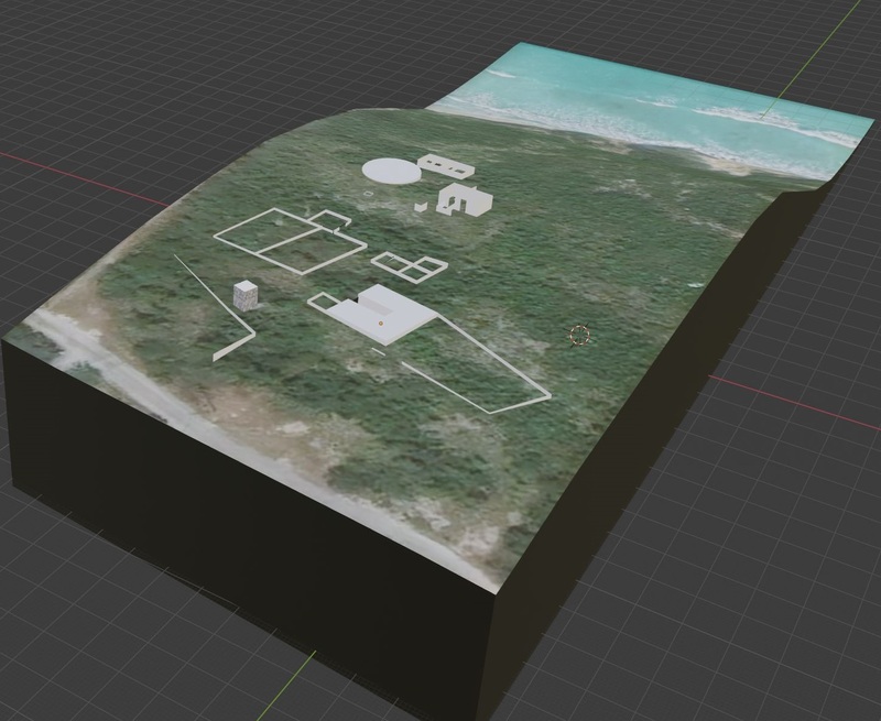
3D model of Hughes Estate Mapped Structures
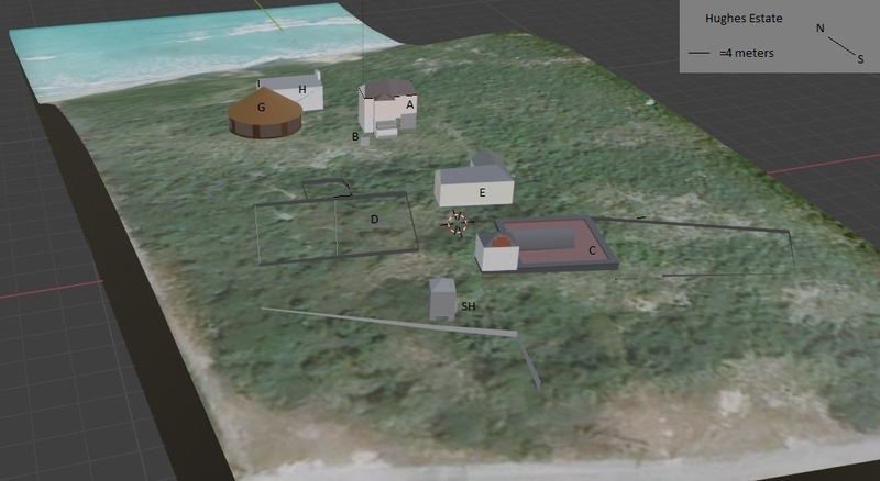
Reconstructed View
3D Model of Hughes Estate:
In 2020-21 we began to build the historic structures we recorded from our 2019 fieldwork in Blender. With a GIS addon, we took advantage of working in 3D by adding topographic data to our new map. This model gives context for current structure heights as well as how the structures relate to the geography of the site.
The model on the top right is a 3D reconstruction of the structures at the site as they appear today, and model below it is a historical reconstruction that we created. Examples of 18-19th century Anguillan and Caribbean plantation architecture guided our reconstruction.
Where on Anguilla is Hughes Estate?
See the approximate location of Hughes Estate on the interactive world map below.
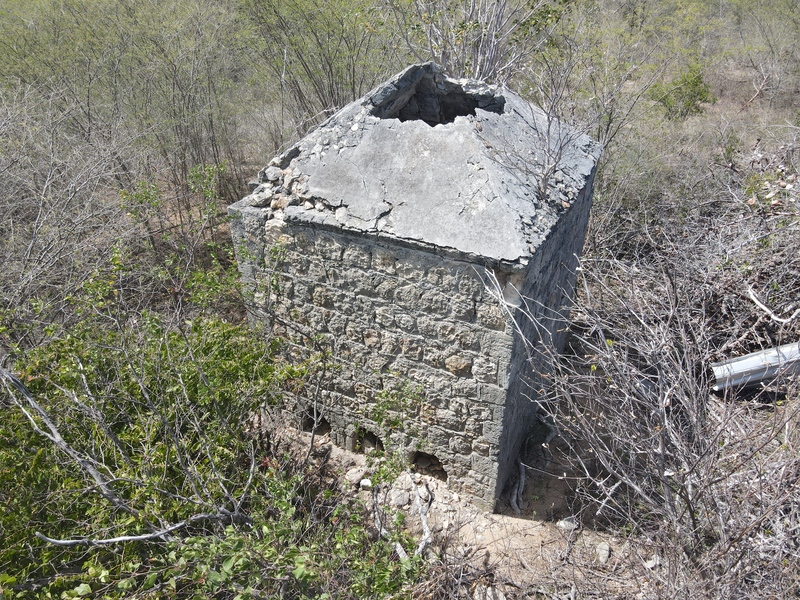
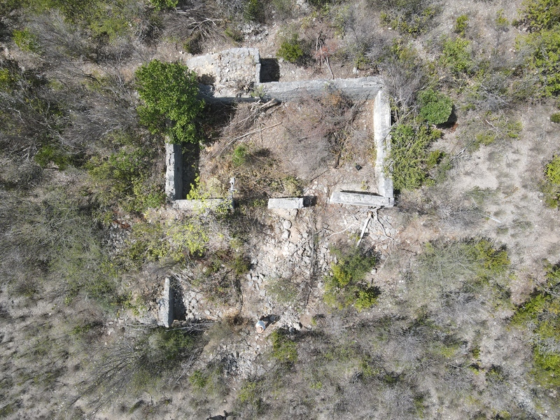
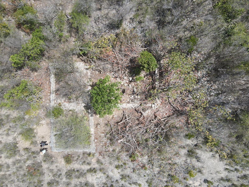
2021 Drone Images
During the 2021 season we cleared enough bush to capture excellent aerial imagery of the site with the assistance of Khori Hodge and his impressive drone skills.
Title
Description
Crew members:
Don Mitchell CBE QC, Anguilla;
Kedira Joseph, Intern, Anguilla Department of Youth and Culture;
Temple University:
Rose McLaughlin,
Elysia Petras,
Cara Tercsak,
Sydney Tushar
Item sets


